
Harrison Postal Coverage
Four ZIP codes are verified as serving the Town of Harrison in the Westchester regional health profile: 10528, 10577, 10580, and 10604. The useful distinction is not a claim that each sits wholly inside Harrison. The county profile marks 10580 and 10604 as serving other regions. USPS location pages confirm the Harrison and Purchase offices, while parcel and municipal records remain the proper way to verify the government location of a specific address.
| Postal ZIP | Harrison relationship | Post office | Important limit |
|---|---|---|---|
| 10528 | Harrison postal area, including downtown context and much of Town/Village context | Harrison Post Office | Postal label is not a legal parcel boundary |
| 10577 | Purchase postal area | Purchase Post Office | Purchase is a Harrison community, but delivery may extend beyond the municipal line |
| 10580 | Rye postal area serving other county regions | No Harrison-specific counter was verified | Do not classify each 10580 address as Harrison |
| 10604 | West Harrison / White Plains postal area serving other regions | USPS place-name notice supplies the verified context | Place name changed in 2024 without a ZIP change |
A Harrison ZIP record search should preserve the ZIP, postal place, municipality, parcel ID, and date of each comparison. The county profile supports the four-code list, but no official parcel-level ZIP crosswalk or full ZIP-boundary map was located. That gap is a reason to verify each search result through the Assessor or GIS instead of expanding the table with an unverified delivery map.
Harrison 10528 Postal Office
The USPS Harrison location result identifies the Harrison Post Office at 258 Halstead Ave, Harrison, NY 10528-9998. The listing shows telephone number 914-835-4937 and retail hours of Monday through Friday from 9 to 5, with Saturday hours from 10 to 3. It confirms an office serving the 10528 postal area; it does not define every delivery boundary or establish that an address is inside the Town/Village.
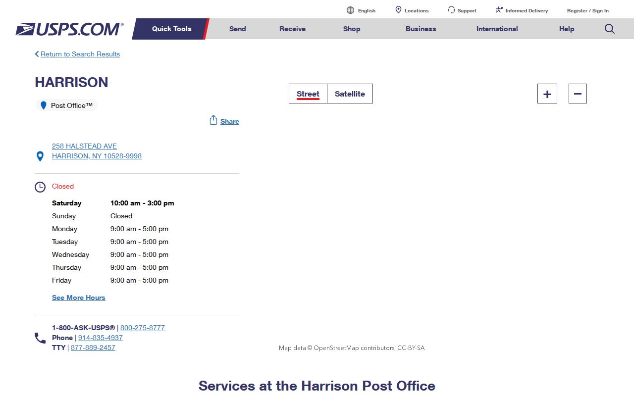
The USPS result is a useful first postal check. Follow it with the physical parcel's GIS and Assessor record when the mailing line, postal place, and municipality appear to disagree.
Harrison 10577 Postal Office
The USPS Purchase location result identifies the Purchase Post Office at 3003 Purchase Street, Purchase, NY 10577-9998. The result gives telephone number 914-761-1562 and retail hours of Monday through Friday from 9 to 6, with Saturday hours from 9 to 2. Purchase is part of Harrison's community geography, but the postal service area must not be presented as a complete municipal boundary.
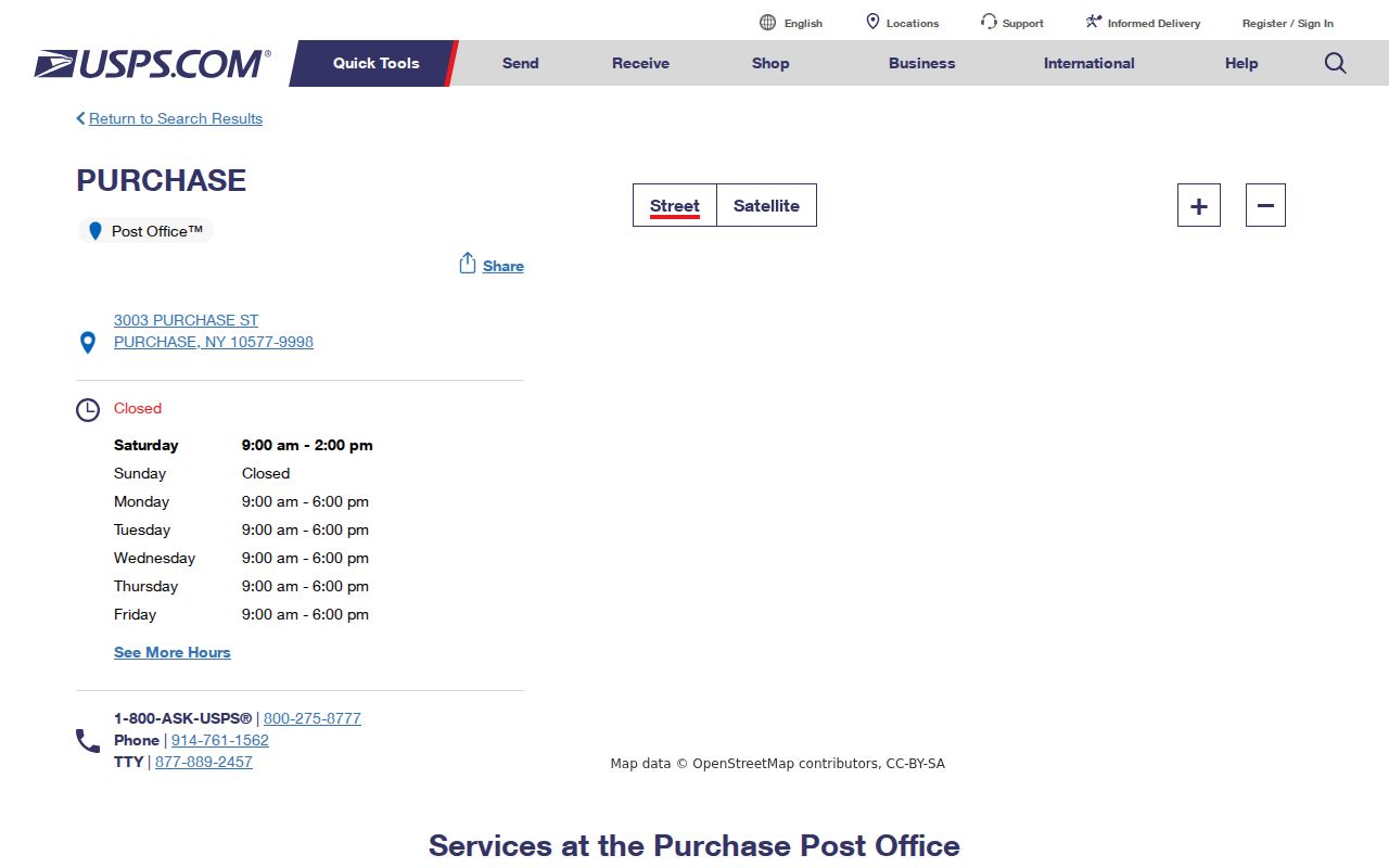
Use the Purchase office result to confirm the postal reference, then use a parcel identifier and Harrison records for the jurisdictional answer. The two checks solve different problems and should be kept as separate notes.
Harrison ZIP Areas Serving Elsewhere
10580 is a Rye postal area that serves other regions in the county profile. Research did not locate a USPS counter page tying 10580 to a specific Harrison parcel. 10604 is also a shared-area code. Its relationship is particularly easy to misread because the relevant postal-place wording has changed. Neither code should be used as a shortcut for calling an address Harrison, even when a record search begins with a Harrison-related name.
Tax material illustrates the formatting issue without settling a boundary. It includes 80 Oak Street as West Harrison 10604, 4 Rye Ridge Road as Harrison 10528, and Rye 10580 records. These are address-format examples. The Assessor and GIS are the checks for municipal identity. A ZIP is delivery geography, while the parcel and legal description are the more reliable property keys.
Note: Shared postal codes require a parcel-level municipality check before records from different places are combined.
Harrison 10604 Postal Name Change
USPS published a March 21, 2024 notice changing 10604's place name from White Plains classified branch to West Harrison. USPS retained the ZIP. This is a place-name change, not verified evidence of a Harrison-wide ZIP reassignment or a boundary realignment. It explains why a search of a Harrison address can return White Plains in an older record and West Harrison in a newer postal reference.
Keep the ZIP and the record date together when comparing Harrison sources. Search alternate place wording where needed, then use the local parcel record to avoid treating the delivery label as the final jurisdiction. No official historic split, merge, or earlier realignment date was located for 10528, 10577, 10580, or 10604.
Finding Harrison Records by ZIP
A postal ZIP can narrow a Harrison search, but it does not act as a complete resident index. Start with the ZIP and the municipality in the address. Next, test the precise street address in the property route. Harrison eTRAKiT has Address, Parcel #, and Owner search modes, but no verified ZIP field. The address search and the returned parcel are therefore the bridge from a ZIP clue to a property record.
The Harrison eTRAKiT parcel search is the verified property route for moving from a full address to a parcel record.
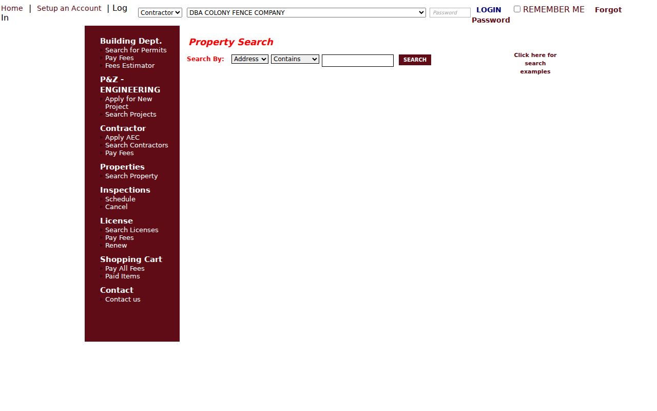
The captured search screen confirms address, parcel number, and owner inputs, not a ZIP-only field. The returned parcel should be checked against its municipal context.
- Confirm the ZIP's postal reference through the appropriate USPS location result when one is available, and write down the postal place exactly as shown.
- Enter the complete Harrison-area address in Harrison eTRAKiT, then save the returned situs address, parcel ID, owner field, legal description, and search date.
- Check the parcel through Harrison Engineering's GIS route or the Assessor to confirm the Town/Village relationship. A shared ZIP requires this step.
- For a specific person, use the state voter lookup only with its required personal fields. The public form does not produce every registrant in a ZIP.
- Use the legal description or parcel ID for WRO, permits, or other property records when the ZIP and postal place no longer resolve the match.
Once a ZIP result becomes a known street and parcel, the Harrison street directory provides the fuller address-record sequence. Keep that later street search tied to the same parcel key, not only to a matching mailing line.
Harrison Voter ZIP Fields
The New York State voter tool is the verified public portal in this research that visibly accepts a postal ZIP. It is an individual registration and poll-site workflow, not a ZIP-wide list. It requires JavaScript and cookies, and the exact public result card was not captured. Use it to check a person-specific registration question, never as an estimate of every person living in a Harrison ZIP area.
| Voter lookup field | Role in a ZIP search | Harrison limit |
|---|---|---|
| County | Selects the county context | Choose Westchester for a Harrison inquiry |
| Last Name | Identifies the individual | Required input in the visible flow |
| First Name | Helps distinguish names | Required input in the visible flow |
| Date of Birth | Person-specific matching field | Displayed as MM/DD/YYYY |
| Postal ZIP | Registration ZIP input | Visible field behavior may be dynamic |
| Address information | Additional registration context | Exact live subfields were not fully exposed |
| Search | Runs the individual lookup | Does not publish a ZIP roster |
New York registration records are public subject to Board of Elections supervision, Election Law limits, and confidential-voter protections. The state form is not a substitute for a full voter-file request. Those requests carry an elections-purpose requirement, and protected addresses can remain unavailable. A ZIP nonmatch does not prove that a person never had a Harrison connection.
Harrison ZIP Search Boundaries
The New York Department of State public license search accepts optional City, ZIP, and County filters. It can associate a professional or business record with a ZIP, but its privacy notice says residence addresses are not included. That makes it unsuitable for identifying parcel occupants. A Westchester contractor-license route also offers City, State, or ZIP geography, with the same need to distinguish a license result from a household or parcel record.
Likewise, eTRAKiT offers no verified ZIP field. It should be searched by an address, parcel number, or owner after the ZIP has narrowed the question. The GIS route can help verify an address and parcel, but the research did not confirm a live Harrison ZIP-boundary layer. Do not draw a boundary from a text label when the official GIS layer list has not been verified.
Note: A ZIP-associated business or license record is not evidence that a person lives at an address.
Harrison Postal Address Keys
Harrison property and postal research uses several keys that can disagree without creating an error. The table clarifies why a ZIP alone should not decide which municipal records apply. Use the key that matches the record type, and compare the parcel and legal description before joining results from different sources.
- Situs address
- The physical parcel or building location. GIS, the Assessor, permits, inspections, and addressing use this key.
- Mailing address
- A correspondence destination used for tax or assessment mail and some election material. It can differ from the parcel location.
- Legal description
- The land identity used in deeds, WRO, plats, maps, and title work. It can remain stable when a postal line changes.
- Parcel, lot, or block
- An administrative and legal crosswalk used by the Assessor, GIS, Building Department, WRO, and tax material.
- Postal ZIP
- USPS delivery geography. It is useful in postal, voter, and licensing contexts but does not replace the property key.
ZIP+4 adds delivery-point detail to a base ZIP. A post-office-box ZIP directs mail to boxes rather than describing all street delivery. A unique ZIP may serve a single institution, and a carrier route is a delivery grouping. None of those terms was identified in the research as a Harrison parcel-boundary system.
Harrison ZIP Municipal Limits
Postal ZIP boundaries and Harrison municipal limits are different systems. The postal place can be Harrison, Purchase, West Harrison, White Plains, or Rye depending on the address and record date. The Town/Village relationship comes from local property and government sources, not from the ZIP label. This matters most for 10580 and 10604, which the county profile marks as serving other regions.
For a conflicted record, compare the full situs address, parcel ID, legal description, postal ZIP, and record date. Then ask Harrison Engineering or the Assessor about the parcel's municipal status. This method keeps a Harrison postal reference useful without overstating delivery geography as a resident list, a land boundary, or proof of current occupancy.
Postal privacy limit. A ZIP can narrow an address search, but it cannot justify compiling or publishing a household list from private information.