
Harrison Neighbor Block Record Coverage
A block search should separate spatial records from person records. Harrison's GIS route gives the parcel geometry needed to identify adjacency. The Assessor and eTRAKiT can then be checked one parcel at a time for property and ownership details. Tax records add dated assessment context. Westchester Records Online, or WRO, is for title history rather than a block roster. The official voter form is person-specific, and building files follow municipal-search, FOIL, and owner-permission limits.
| Source | What it shows about a block | Access |
|---|---|---|
| GIS parcel layer | Spatial adjacency, situs addresses, and parcel identifiers | Town and Westchester GIS route; live layer controls are unconfirmed |
| eTRAKiT and Assessor | Owner and property information for a selected parcel | Query one parcel at a time; not all occupants |
| Westchester Records Online | Recorded title and transfer history for a selected parcel | Public index with an account or image boundary |
| Tax roll | Dated owner or taxpayer and assessment context | Public roll or office route; not a household record |
| Voter lookup or file | Individual registration and polling information, or permitted file fields | Person-specific lookup; election-purpose and protected-voter rules apply |
| Building records | Permits, certificates, violations, or inspections by address | Municipal search, FOIL, and owner-permission limits |
| Historical directories and civic sources | Past address clues or public community context | Library, archives, or official contacts; no member roster assumed |
The resulting table should contain an address, parcel ID, map date, and source date. It should not label a person as a current neighbor merely because a map polygon touches another polygon.
Map a Harrison Neighbor Parcel
Harrison Engineering states that its GIS data is available through Westchester County and used by the Town/Village. The confirmed static map workflow is simple: find the target parcel, select it, read the address or information panel, then inspect neighboring polygons. The static capture supports highlighting and an information panel. A live buffer, radius, measuring tool, or layer list was not confirmed, so none should be treated as a verified search feature.
- Find the target GIS polygon and record its situs address and parcel ID.
- Select each touching parcel, or pan along the immediate frontage, and record each adjoining address and ID.
- Query each recorded parcel in eTRAKiT or with the Assessor, preserving the date of each check.
- Use WRO only when the question is title history, then compare the deed's legal description with the parcel.
A road right-of-way, school, park, common parcel, cemetery, shared drive, or other nonresidential polygon can appear adjacent on a map. Parcel geometry identifies land relationships. It does not describe social relationships or occupancy.
Note: Contact Harrison Engineering's GIS route at 914-670-3102 when the map, address, or parcel reference conflicts.
Check Harrison Neighbor Parcels
The Harrison eTRAKiT parcel search accepts Address, Parcel #, or Owner as its Search By choices. The visible operator is Contains. Result areas include Parcel Info, Owner Info, Restriction Details, Land Use, Building, Legal Desc, and Inspections. Map On/Off, Print, and Export To Excel controls were visible during inspection, with five result rows in the inspected configuration. Use the parcel ID first, rather than guessing that a similar street number is the same land.
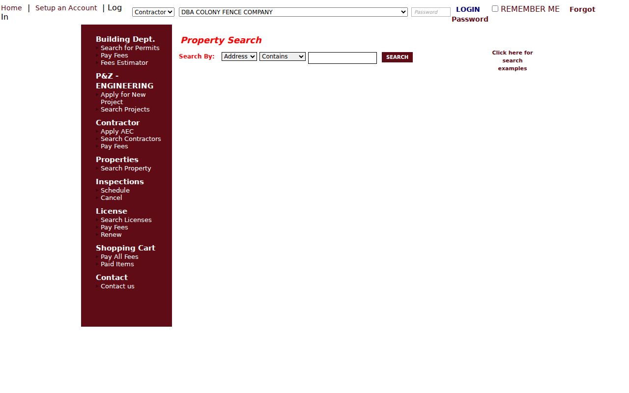
Search results still need a selected parcel and a recorded date. An owner result and a tax mailing clue do not establish who occupies the parcel.
Save the owner name exactly as shown, the situs address, mailing address only if it is shown, legal description, land-use or building information, and the date checked. The portal's public lookup remains available after the September 3, 2024 change that ended new electronic building-application intake. Existing application functions and a parcel lookup are not a statement about a person living at the parcel.
Trace Harrison Neighbor Title History
Westchester Records Online is the county route for recorded deeds, mortgages, liens, and maps. Search the selected parcel's current owner as a grantee, then record the grantor, grantee, recording date, document or book reference, and legal description. If title history matters, search the prior grantor as a grantee in an earlier period. Work from the legal description when a lot split, subdivision, trust, entity, or older place name makes a street string unreliable.
WRO advertises index coverage from eighteenth-century deeds to recent judgments, but the public landing page does not establish a universal online-image cutoff. The free index and paid or account-gated images are different access levels. For older records, Westchester Archives publishes grantor/grantee coverage from 1680 to 1907. A title record identifies a recorded ownership event, not a present household.
Keep Harrison Neighbor Voter Checks Personal
The New York State Voter Lookup asks for Westchester County, last and first name, date of birth in MM/DD/YYYY format, and ZIP or address information. It can support an individual registration or polling-information check. It cannot display every voter on a Harrison street. A full voter-file request has a separate Board of Elections route, is bound to an elections purpose under Election Law §3-103(5), and remains subject to the withheld-information rule in §3-220.
Confidential registration under Election Law §5-508 is kept separate from public access. A no-result is not proof that a person is absent from a block. Never infer a family relationship from an address, or turn a lawful file into a published neighborhood roster.
Use Harrison Neighbor Community Contacts
Public organizations can provide historical or civic context without supplying a private membership list. The research identified contacts for the History Preservation Board and History Center, the Library and Harrison Remembers, and Town community and recreation services. They are routes for public programs, archives, or events. They are not resident directories.
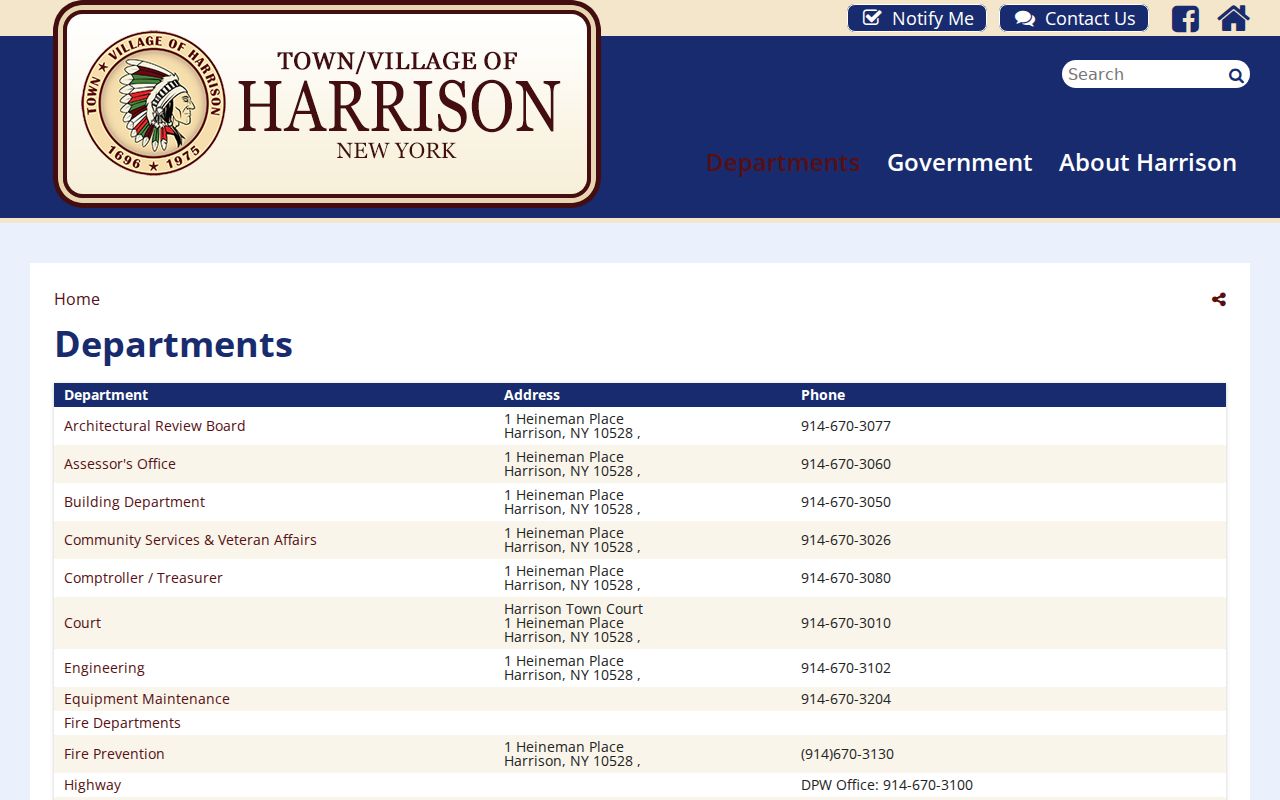
The office listing can direct a researcher to public services and archival help, but it does not identify participants, members, or nearby occupants.
| Public contact route | Use and directory boundary |
|---|---|
| History Preservation Board / History Center | Town history contact, history@harrison-ny.gov, 914-948-2550. Historical records and preservation context, no member directory. |
| Harrison Public Library / Harrison Remembers | Library research resources; 2 Bruce Avenue, 914-835-0324. Public research and memory-project contacts, no participant list. |
| West Harrison Library branch | 914-948-2092. Public library help, not a resident affiliation record. |
| Community Services and Recreation | Community Services: 914-670-3026, community@harrison-ny.gov. Recreation: 914-670-3035. Public program and center contacts, not membership rosters. |
The Town identifies public recreation and community centers, including the Harrison Community Center, Leo Mintzer Community Center in West Harrison, and senior centers. Those places may point to public activities or services. The research did not locate a verified current neighborhood-association member directory, so no association name or membership should be inferred.
Separate Harrison Neighbor Context From Membership
Harrison Remembers, the History Center, library sources, and regional historical collections can add context about places such as Silver Lake, Stony Hill, Purchase, or West Harrison. They can support a date, institution, map, oral-history theme, or surname research path. They cannot prove that a person belongs to a group, attended an event, or knows people living nearby.
Historical directories are useful only as dated address or householder clues. No confirmed Harrison-specific directory run was located, and no current public civic or neighborhood member list was verified. Keep a historical directory entry separate from a current property record and state the period it represents.
Compare Harrison Neighbor Record Categories
Official parcel, assessment, voter, court, and deed records have a named custodian, a date, and a defined scope. A commercial neighbor category may combine marketing data, public filings, old directories, and purchased information. That combination can merge same-name people, retain stale addresses, or omit protected records. It is not proof of identity or occupancy.
| Official parcel and title records | Commercial neighbor category |
|---|---|
| Shows a defined parcel, recorded owner or dated tax context | May group names or addresses from mixed and differently dated sources |
| Can be checked with the Assessor, County Clerk, or stated custodian | May not show the original custodian, date, or correction path |
| Does not claim every occupant or personal relationship | Can overstate a proximity match as a person or household match |
For a broader current address trail, the Harrison by-street directory uses the street-level workflow. The immediate-block method remains parcel-focused and should remain small enough to verify.
Read Harrison Neighbor No-Knock Form
Harrison's Town Clerk page displays an address-keyed no-knock registry form.
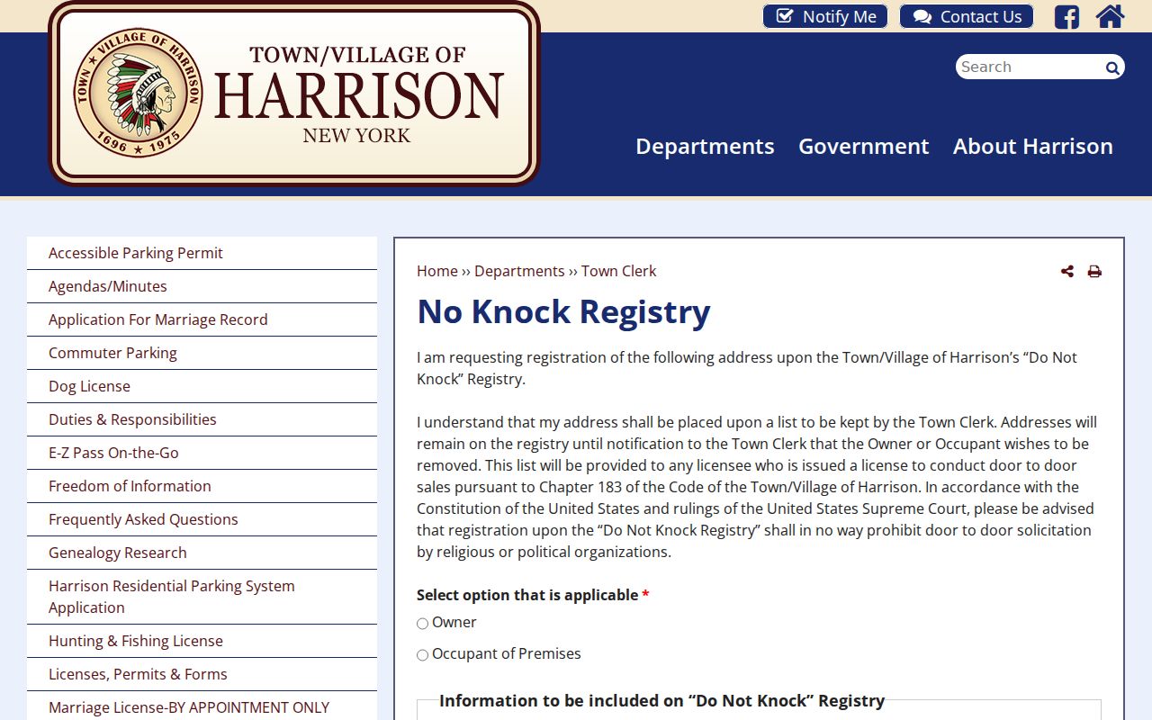
The form is an address-keyed Town Clerk webform. Its presence does not establish the contents, availability, or status of any individual record, and it should not be used to infer who lives at an address.
Respect Privacy Limits for Harrison Neighbors
New York's Address Confidentiality Program protects an eligible participant's actual address through a substitute address under Executive Law §108 and 19 NYCRR Part 134. Confidential voter registration under Election Law §5-508 is a separate protection. Court and vital files can be sealed or limited. DMV information is restricted under the DPPA, and utility, delivery, and complete household information are not public block records.
Do not treat a parcel owner as every person at the situs, a tax mailing address as physical occupancy, or a map match as a social connection. If a map, record, or address appears wrong, contact the Assessor or Engineering and retain the dated source details for correction.
Lawful use. Use Harrison neighbor records for careful, lawful personal research and civic context. Do not use addresses, records, or contact details to stalk, threaten, intimidate, or harass another person.